Byron Bay Australia Map: Navigate This Coastal Gem
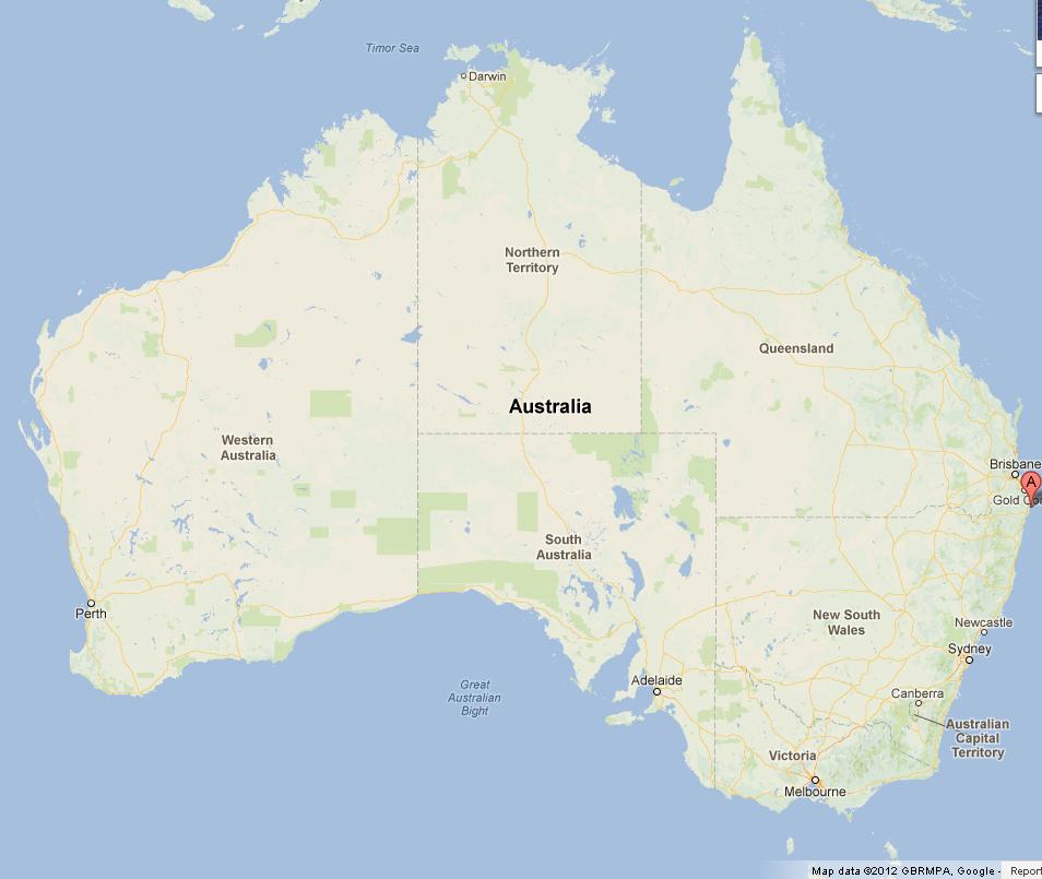
Byron Bay, a coastal jewel in southeastern Australia, offers an enthralling blend of natural beauty and vibrant culture. Situated at the easternmost point of the Australian mainland, this idyllic town has become a favored destination for travelers seeking a serene escape, adventure, or cultural immersion. Understanding the landscape through a detailed map of Byron Bay not only aids in navigation but also enhances one’s appreciation of this exquisite locale.
Exploring the Cartography of Byron Bay
A comprehensive map of Byron Bay serves as a pivotal tool for visitors. It unveils the diverse attractions that the region has to offer. The northernmost point, Cape Byron Lighthouse, stands sentinel over the coastline. A visit to this historic lighthouse, fringed by lush greenery, provides a magnificent vantage point from which to witness the interplay of sea and sky. The winding paths leading to the lighthouse are adorned with local flora, inviting visitors to meander leisurely while soaking in the stunning vistas.
In addition to its iconic lighthouse, the map showcases the pristine beaches that define Byron Bay’s shoreline. Main Beach, known for its golden sands and azure waters, is a hub of activity, offering surfing, swimming, and sunbathing opportunities. Conversely, Tallow Beach, nestled further away from the bustling town center, presents a tranquil escape, perfect for intimate walks along the foreshore. Each beach has its unique charm, and a map facilitates exploration of these coastal sanctuaries.
The map also reveals the intricate network of walking trails, most notably the Cape Byron walking track, which winds through the hinterland and offers spectacular views of the ocean. This trail is dotted with lookout points, ensuring that hikers are rewarded for their efforts with breathtaking panoramas of the coastline. The lush vegetation encompassing the trail is rich in biodiversity, showcasing various plant species and the occasional glimpse of indigenous wildlife. This juxtaposition of physical activity and natural beauty captivates the senses and leaves an indelible impression on all who venture along the path.
Diverse Landscapes and Cultural Heritage
Byron Bay is not solely about beaches; its interior is a tapestry of rolling hills, lush rainforests, and charming hinterland towns. A detailed map aids in uncovering these hidden gems, including the vibrant community of Bangalow, which boasts eclectic shops and delightful cafes. The slow pace of life in these areas contrasts beautifully with Byron Bay’s bustling beachfront, inviting travelers to experience the region’s cultural tapestry more deeply.
The area is rich in Aboriginal history, and exploring the map leads visitors to places of significance, offering insights into the rich heritage of the Indigenous people who have cared for this land for millennia. The beauty of Byron Bay is intertwined with its cultural narratives, engaging visitors in stories that resonate through time.
With annual festivals and a vital arts scene, the map is instrumental in locating venues and events. The Byron Bay Film Festival, for instance, draws filmmakers and enthusiasts from around the globe, while the infamous Bluesfest showcases local talent and international acts, making this coastal town a melting pot of creativity and expression. Understanding the geographical layout allows for effortless navigation through lively streets pulsing with the rhythm of music and art.
Navigational Insights for a Memorable Experience
Equipped with a profound understanding of the map, visitors can maximize their experience in Byron Bay by planning their itinerary with intention. Whether it’s embarking on a surfing adventure at one of the many renowned surf schools or indulging in fresh, gourmet cuisine at local eateries, having a navigational reference is vital for a fulfilling visit.
Furthermore, the proximity of Byron Bay to other attractions—such as the lush hinterland of the Nightcap National Park and the nearby town of Lennox Head—encourages day trips that expand the adventure beyond the beach. The map acts as a gateway to wider exploration, enhancing one’s journey through the breathtaking landscapes of New South Wales.
In conclusion, the journey through Byron Bay is one of discovery, laden with opportunities for adventure, reflection, and connection with nature and culture. A detailed map is not merely a navigational aid; it is an invitation to delve deeper into the heart of this coastal gem. By embracing the wonders that lie within its diverse landscapes, visitors are assured of an experience that promises to reshape their perspective on the beauty of Australia.
You May Also Like
Best Fish to Catch in Australia: A Guide for Anglers
Australia boasts an extraordinary diversity of fish species, making it …
Emily Bay Norfolk Island: A Hidden Gem in the Pacific
Emily Bay, a picturesque enclave nestled on the sun-kissed shores of …
Holidays on August 23: Global Festivities & Observances
August 23 is a date that carries a bouquet of cultural significance …


